Resolving Gair Mumkin Khad Concerns
The issue of Gair Mumkin Khads in Jammu and Kashmir has for long remained a complex matter involving land classification, flood safety, environmental protection, and public concerns. The meeting of the sub-committee chaired by Deputy Chief Minister Surinder Choudhary at the Civil Secretariat, Jammu, therefore assumes significance because it seeks to bring clarity, balance, and practical direction to an issue that has affected people across several districts. The emphasis on identifying chronic areas, protecting flood-prone zones, and undertaking scientific mapping reflects a sensible approach to a sensitive subject.
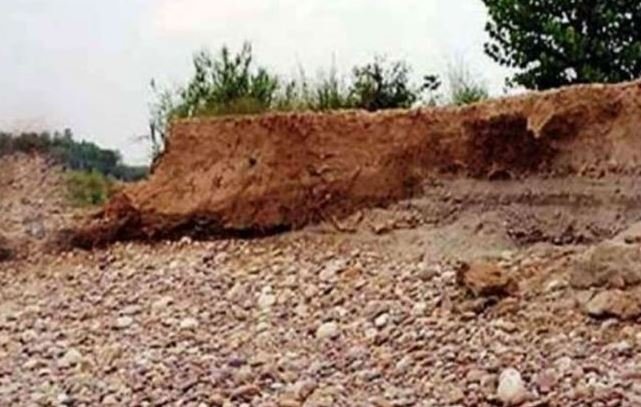
Gair Mumkin Khads, daryas, nallahs, and adjoining non-cultivable lands cannot be viewed only through a narrow administrative lens. Many such areas have direct bearing on natural drainage, flood passage, and ecological stability. At the same time, people living in or around these areas often face genuine difficulties related to land use, ownership clarity, development restrictions, and procedural uncertainty. A fair policy response must therefore protect natural water channels while also addressing the legitimate grievances of citizens. The subcommittee’s stress on the protection of all flood zone areas is both necessary and responsible. In a region vulnerable to sudden rainfall, flash floods, and changing weather patterns, any casual approach towards water bodies and drainage channels can create serious long-term risks. Encroachment, unplanned construction, and disturbance of natural flows can endanger lives, property, and infrastructure. Flood safety must remain a non-negotiable priority. However, the call for identifying chronic areas is equally important. Not every case can be treated in the same manner. Ground realities differ from district to district and from one location to another. Some areas may require strict protection because of their hydrological importance, while others may need careful review because public hardships have accumulated over time due to unclear records or outdated classification. This is where scientific mapping becomes crucial. Decisions based on old assumptions, incomplete records, or generalized categories may not serve either public interest or environmental safety. Zone-wise mapping of Gair Mumkin Khads, nallahs, and adjacent non-cultivable wastelands can help the administration create a more transparent and reliable database. Such mapping should use modern technology, field verification, revenue records, flood history, drainage patterns, and local inputs. Once accurate information is available, policy decisions can be more practical, fair, and defensible. It will also reduce confusion among departments and citizens. The presence of key ministers and senior officers in the meeting indicates that the issue requires coordinated departmental action. Revenue, Jal Shakti, Irrigation and Flood Control, Forest, Rural Development, and local bodies must work together rather than operate in isolation. Many land-related problems become complicated because citizens receive different interpretations from different departments. A time-bound and coordinated mechanism can reduce delays and build public confidence. Deputy Chief Minister Surinder Choudhary’s direction for detailed reports and timely completion of mapping is welcome. The challenge now lies in ensuring that these directions are implemented on the ground with seriousness. Public concerns should be heard patiently, but decisions must be guided by law, science, and long-term safety. A people-centric approach does not mean compromising flood protection. It means applying rules with fairness, clarity, and sensitivity. Stakeholder sensitization is another important requirement. People must understand why certain flood-prone areas need protection and why natural channels cannot be disturbed. At the same time, officials must understand the genuine difficulties faced by citizens in matters of land records, permissions, and livelihoods. Dialogue can help reduce mistrust and make solutions more acceptable.
The issue of Gair Mumkin Khads is not merely about land. It is about responsible governance, environmental wisdom, and public welfare. Jammu and Kashmir needs a balanced framework that protects rivers, nallahs, and flood channels while also resolving genuine cases through transparent procedures. If the sub-committee continues its work with scientific discipline, inter-departmental coordination, and public sensitivity, it can create a model for fair and sustainable land governance. This is an opportunity to move from confusion to clarity, from grievance to resolution and from fragmented action to responsible policy.