IMD Warns of Heavy Rain in North India Till July 12, Monsoon Set to Cover Entire Country Soon
The weather office has warned of sustained rainfall across Haryana, Punjab, Himachal Pradesh, Chandigarh and Delhi, while the southwest monsoon is expected to spread across the remaining parts of the country within the next few days.
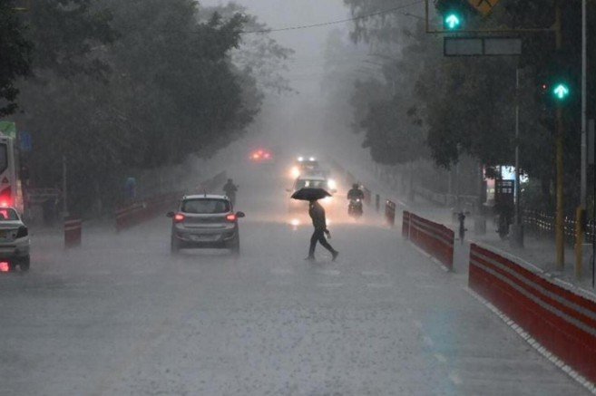
India, July 09 : North India is set for a fresh and intense phase of monsoon activity, with the India Meteorological Department forecasting widespread rainfall and heavy showers across several states over the coming days. Haryana, Punjab, Himachal Pradesh, Chandigarh and Delhi are expected to remain under the influence of an active monsoon system, while weather conditions are also turning favourable for the southwest monsoon to complete its advance over the remaining parts of the country within the next two to three days.
According to the latest weather bulletin issued by the India Meteorological Department on Thursday, rainfall activity is expected to stay strong across the northwestern region as a combination of favourable atmospheric systems continues to fuel monsoon conditions. The forecast points to a sustained wet spell over large parts of north India, with heavy rain likely to affect both plains and hill states, raising the possibility of waterlogging, traffic disruption and localised flooding in vulnerable pockets.
Punjab is likely to witness widespread rainfall activity on July 9, while Haryana, Chandigarh and Delhi are expected to receive widespread to fairly widespread showers on July 9 and 10. Himachal Pradesh, meanwhile, is set to remain under a prolonged spell of active monsoon conditions, with widespread rainfall forecast from July 9 to July 14. This indicates that the hill state could continue to see frequent rain episodes for nearly a week, increasing the risk of slippery roads, overflowing drains and disruptions in mountainous districts.
The weather office has also issued a heavy rainfall warning for Haryana, Chandigarh, Delhi and Punjab from July 9 to July 12. Himachal Pradesh is expected to receive heavy showers for an even longer period, from July 9 to July 14. Uttarakhand, too, is likely to see significant rain activity during this phase, with the possibility of isolated very heavy rainfall on July 10. Such a forecast suggests that the broader north Indian region may remain under a strong monsoon influence well into the middle of July.
Meteorologists said the current spell is being driven by a well-marked low-pressure area located over northwest Madhya Pradesh and adjoining southwest Uttar Pradesh. This weather system, combined with an active monsoon trough extending across northern India and other supportive atmospheric conditions, is helping channel moisture into the region and intensify rainfall activity. The interaction of these systems is expected to keep rain-bearing clouds active over northwest India for the next several days, sustaining the monsoon surge across both urban centres and rural belts.
The latest observations show that rainfall activity has already picked up in several parts of the region. During the 24 hours leading up to Thursday morning, isolated places in Haryana, Chandigarh and Delhi recorded heavy rainfall, while Punjab saw rain at many locations. Uttarakhand received rainfall at most places, indicating that the monsoon has already strengthened significantly across the northern belt. In the national capital, Safdarjung recorded 7 cm of rain during the 24-hour period ending at 5.30 am on Thursday, underlining the intensity of the wet spell already underway.
The IMD has urged residents in the affected states to stay alert as heavy rain could lead to temporary flooding in low-lying localities, traffic jams in urban centres and interruptions to normal daily routines. Areas with poor drainage are particularly vulnerable during sustained rainfall spells, and authorities are likely to keep a close watch on locations that have a history of water accumulation during the monsoon season. Commuters have been advised to exercise caution while travelling, especially during periods of intense rain, and to avoid waterlogged roads and underpasses wherever possible.
For cities such as Delhi and Chandigarh, where even a few hours of heavy rain can cause severe traffic congestion, the forecast raises the possibility of significant disruption during peak travel hours. Waterlogging on roads, slower vehicle movement and delays in public transport are among the most immediate concerns whenever strong monsoon systems remain active over the plains for multiple days. In parts of Haryana and Punjab, heavy rainfall could also affect local connectivity, especially in areas where rural roads are prone to damage or inundation.
In Himachal Pradesh and Uttarakhand, the situation requires even greater vigilance because prolonged rainfall in hill states can increase the risk of landslides, mudslides and road blockages. Mountainous terrain is particularly vulnerable when repeated rain spells saturate the soil and weaken slopes. While the IMD bulletin focuses on rainfall intensity and spread, local administrations in the hill states may also monitor river levels, road conditions and landslide-prone zones as the wet spell unfolds.
Despite the risks of disruption, the monsoon activity is expected to provide relief from the hot and humid weather that had persisted across many parts of north India. Over the past several days, high moisture levels and warm conditions had created uncomfortable weather in the plains, particularly in Delhi, Haryana and Punjab. Fresh rain is likely to bring temperatures down, improve atmospheric comfort and offer a break from the oppressive humidity that has been affecting residents.
The rainfall is also expected to benefit the agricultural sector, especially kharif cultivation, which depends heavily on the timely arrival and healthy distribution of monsoon rains. Improved soil moisture and better water availability can support sowing operations and strengthen crop growth in key farming regions across Haryana, Punjab and adjoining states. For farmers, a steady monsoon at this stage of the season is crucial, though excessive or poorly distributed rainfall can also create local challenges such as field waterlogging and damage to newly sown crops.
The broader significance of the forecast lies in the expected advance of the southwest monsoon over the remaining parts of the country. The IMD has indicated that atmospheric conditions remain favourable for the monsoon to move into the remaining areas of Haryana, Punjab and Rajasthan and complete its coverage of the entire country within the next two to three days. This would mark an important seasonal milestone, as the monsoon’s full spread across India is closely tracked for both agricultural planning and regional weather outlooks.
A complete monsoon cover does not mean uniform rainfall everywhere, but it does signal that the seasonal rain-bearing system has reached all parts of the country. From there, the focus shifts to how evenly the rains are distributed and whether key agricultural and water-stressed regions receive adequate precipitation. In north India, however, the immediate concern is not the arrival of the monsoon but the intensity of the current wet phase and its likely impact on transport, daily life and vulnerable infrastructure.
The active monsoon conditions forecast over the next several days reflect the dynamic nature of India’s weather systems during July, when low-pressure areas, monsoon trough shifts and moisture-laden winds often combine to produce strong rainfall episodes. Such spells can be highly beneficial in terms of replenishing reservoirs, improving groundwater recharge and supporting farm activity, but they can also strain urban drainage systems and expose weak points in civic infrastructure.
As the rain-bearing system strengthens across the northern plains and hill states, local administrations may need to stay prepared for short-term disruptions, particularly in flood-prone neighbourhoods and traffic-sensitive urban corridors. Residents in affected areas are likely to be advised to monitor weather updates, avoid unnecessary travel during intense downpours and remain cautious around overflowing drains, low-lying roads and areas vulnerable to sudden water accumulation.
The coming days are therefore expected to be crucial for both weather management and public preparedness across north India. With heavy rainfall forecast for multiple states and the monsoon poised to complete its nationwide advance, the region is entering one of the season’s more active phases. Whether the rains remain largely beneficial or cause widespread inconvenience will depend on the intensity of individual spells and the ability of local systems to manage the runoff.
For now, the IMD’s forecast leaves little doubt that north India should prepare for a sustained monsoon spell. From the plains of Punjab and Haryana to the hills of Himachal Pradesh and Uttarakhand, the next several days are likely to bring frequent showers, heavy rain in many areas and a sharp shift in weather conditions. Along with much-needed relief from heat and support for the agricultural season, the monsoon is also set to test urban infrastructure and public readiness as it gathers strength across the region.