Monsoon Weakens Across Much of India Uttarakhand Placed on Red Alert
IMD forecasts heavy rainfall over Uttarakhand, Northeast and eastern states, while dry weather continues across northwestern and peninsular regions amid below normal monsoon activity.
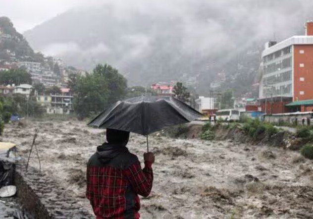
NEW DELHI, July 12: The southwest monsoon remained sluggish across vast stretches of India on Sunday, with rainfall activity largely restricted to Uttarakhand, Himachal Pradesh, West Bengal and several northeastern states. While many regions continued to experience dry weather and above-normal temperatures, the India Meteorological Department (IMD) warned of intense rainfall over parts of northern and eastern India in the coming days, issuing a red alert for Uttarakhand due to the likelihood of extremely heavy showers.
According to the IMD’s latest weather bulletin, isolated heavy to very heavy rainfall is expected over the northeastern states, Bihar and West Bengal during the next two to three days. Eastern Uttar Pradesh may also witness isolated spells of heavy rain within the next four to five days. In contrast, monsoon activity is likely to remain weak across northwest India, western India, central regions and much of the southern peninsula for nearly a week.
Uttarakhand Grapples With Heavy Rain and Landslides
Continuous rainfall disrupted normal life across Uttarakhand on Sunday, triggering landslides at multiple locations and causing widespread road blockages. Officials confirmed that 126 roads, including two national highways, were rendered inaccessible following debris and mudslides in various hill districts.
A wall collapse in Dehradun injured a woman and forced seven families to vacate their homes as a precautionary measure. Emergency teams shifted residents to safer locations while local authorities assessed structural damage in the affected neighbourhood.
The State Emergency Operation Centre (SEOC) reported that the Rishikesh–Yamunotri National Highway remained closed for the third consecutive day after a major landslide near Syanachatti. Restoration work continued throughout the day as road clearance teams battled unstable slopes and intermittent rainfall.
The IMD has urged residents and pilgrims travelling to the Char Dham region to remain cautious, warning that persistent rain may trigger additional landslides, flash floods and rockfalls in vulnerable mountainous areas.
Rain Continues Across Himachal Pradesh
Neighbouring Himachal Pradesh also remained under the influence of wet weather conditions. Light to moderate rainfall was recorded in several districts over the past 24 hours.
Jogindernagar in Mandi district received the highest rainfall at 60 mm, followed by Manali (45 mm), Sarahan (38.5 mm), Rohru (25 mm) and Shimla (19 mm).
In Shimla, falling debris and an uprooted tree temporarily blocked the city’s important Cart Road near the HP Congress Committee headquarters, disrupting vehicular movement for several hours before authorities cleared the obstruction.
Although rainfall brought temporary relief from warmer conditions, officials continued monitoring landslide-prone stretches where saturated slopes remain vulnerable.
Delhi Experiences Warm and Stable Weather
Unlike the Himalayan states, Delhi witnessed dry and stable weather throughout Sunday. Maximum temperatures hovered between 35°C and 36°C, while minimum temperatures remained between 26°C and 28°C.
The IMD observed that daytime temperatures were slightly above seasonal averages at isolated places but remained within normal limits across most parts of the national capital.
Meteorologists do not expect any significant change in Delhi’s temperature pattern during the coming week, with rainfall chances remaining minimal.
Uttar Pradesh Still Awaiting Strong Monsoon Revival
Large parts of Uttar Pradesh also remained rain-free on Sunday. Maximum temperatures were recorded around 36°C, while overnight temperatures stayed close to 26°C.
Eastern districts that received scattered showers reported comparatively pleasant weather, but most regions continued to experience dry conditions.
The weather department has forecast rain and thunderstorms at a few places in eastern Uttar Pradesh over the next 24 hours. Heavy rainfall is also likely at isolated locations in the northeastern districts bordering Bihar.
Lucknow is expected to witness partly cloudy skies before clearer conditions emerge later in the day.
Seasonal Rainfall Deficit Continues in Uttar Pradesh
Despite isolated showers in recent days, Uttar Pradesh remains significantly behind its normal seasonal rainfall target.
Between June 1 and July 12, the state recorded 158.8 mm of cumulative rainfall against the normal 190.9 mm, resulting in a 17 percent rainfall deficit, according to IMD data.
Weather experts say sustained monsoon activity will be necessary over the coming weeks to improve agricultural prospects and replenish reservoirs before the kharif cultivation season reaches its peak.
Dry Spell Persists Across Rajasthan
Rajasthan continued to witness hot and dry weather conditions as the monsoon remained largely inactive across the state.
Sri Ganganagar emerged as the hottest location with a maximum temperature of 41.7°C, followed by Bikaner (39.3°C), Barmer (39°C), Jaisalmer (39°C) and Churu (37.4°C).
The IMD expects dry weather to continue over eastern Rajasthan for the next five to six days. However, isolated light rainfall may occur between July 13 and July 15 across parts of the Shekhawati region, along with sections of Jaipur and Bharatpur divisions.
Authorities have also warned of dust-laden winds across western Rajasthan, particularly over Jodhpur and Bikaner divisions, where wind speeds of 30 to 40 kmph are expected during the next two to three days.
West Bengal Receives Widespread Rainfall
West Bengal remained one of the wettest states on Sunday as active monsoon conditions produced widespread rainfall across both northern and southern districts.
The IMD has forecast heavy rainfall across several districts until July 14, with the sub-Himalayan belt expected to receive particularly intense precipitation.
Districts including Bankura, Birbhum, Purba Bardhaman, Paschim Bardhaman, Nadia and Murshidabad are likely to experience heavy rain over the next two days, while the remaining districts may receive light to moderate showers.
According to IMD observations, Pundibari in Cooch Behar district recorded the state’s highest rainfall at 89 mm during the 24-hour period ending Sunday morning.
Northeast India Likely to Receive More Heavy Rain
Meteorologists expect the northeastern states to continue receiving widespread rainfall over the next several days due to favourable monsoon conditions.
Heavy downpours may affect Assam, Meghalaya, Arunachal Pradesh, Nagaland, Manipur, Mizoram and Tripura, raising the possibility of localized flooding and landslides in hilly terrain.
State disaster management agencies have advised residents living in vulnerable locations to remain alert and follow weather advisories issued by local administrations.
Weather Pattern Remains Uneven Across the Country
The latest weather outlook highlights the uneven distribution of this year’s southwest monsoon, with significant rainfall concentrated over the Himalayan belt and eastern India while vast areas of western, central and southern India continue to experience subdued monsoon activity.
Meteorologists believe this contrast may persist over the coming week, making regional rainfall monitoring crucial for agriculture, water management and disaster preparedness.
Authorities have advised people living in flood- and landslide-prone regions to remain cautious, while residents in dry regions are expected to continue facing warm conditions until monsoon activity strengthens later in the season.